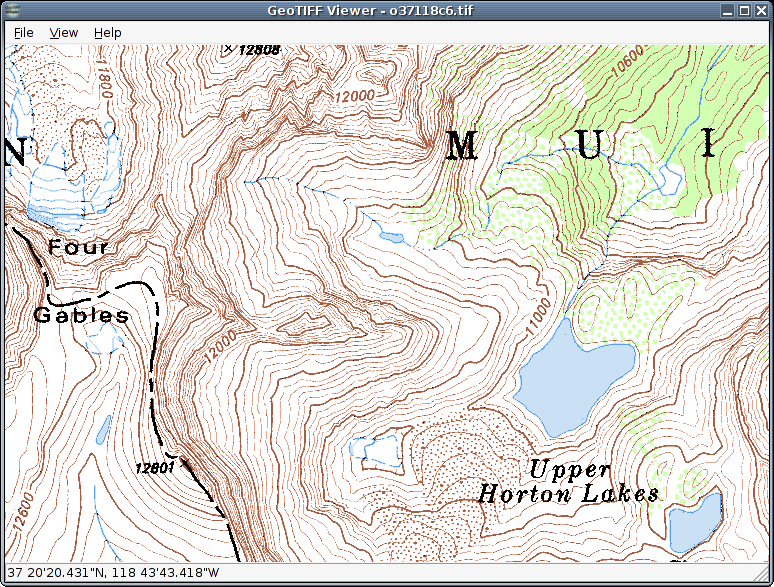
Software screenshot:
Dettagli del software:
Versione: 1.0.2
Data di caricamento: 20 Feb 15
Sviluppatore: Jonathan duSaint
Licenza: Libero
Popolarità: 293
GeoTIFF Viewer è un visualizzatore open source per i file GeoTIFF, che riferimenti geografici immagini raster, solitamente utilizzati per le mappe.
GeoTIFF Viewer utilizza libgeotiff e libtiff per la lettura di file TIFF e tag GeoTIFF associati
Cosa c'è di nuovo in questa versione:.
- configure ora controlla per le intestazioni libgeotiff in / usr / include / GeoTIFF, troppo, dal momento che Ubuntu e il suo ilk usare quella.
- sono stati aggiunti Alcuni ulteriori modifiche minori.
I commenti non trovato